The St. Quintin Park Estate is central to our area of study. We are looking at that part of the Royal Borough of Kensington and Chelsea more or less bounded by: to the east, Ladbroke Grove; to the south, the elevated motorway, A40; to the west, the Cross Link Railway and to the north, Harrow Road.

Map of London W10 (self drawn)
THE LANDSCAPE
A sluggish river meandering through the marshes to the sea, a cluster of huts and a primitive fort by the Walbrook – such was London when the Romans appeared. That part of the river (Thames) below is still known as “The Pool”
Old London Town – Will Owen
In Pre-Roman times there were trackways more or less running along the present routes of Edgware Road, Bayswater Road, and High Street Kensington, each linking areas of high ground. This is due to the physical features of the Thames’ Basin (somewhat flat) and its surrounding hills.
North of the River, starting at Tower Hill in the east, and going due westward, is a string of low hills. Ludgate is adjacent to the Thames but because of its meanderings, Camden Hill is nearly a mile away from the river. The three hills of Bayswater, Notting and Camden are separated by lowland in which the Bays Water or West Bourne and the Bridge or Counter’s Creek flow southward to join the Thames at Chelsea. These five features constitute Notting Hill.
To the north of Notting Hill, gravel gives way to clay, and whereas aggregates were extracted near Silver Street (top end of Church Street) the brick fields lie at Avondale Park, the filled in “Blue Lagoon” (clay pits) of the “Pigs and Potteries”.
Yet a little further north, say three miles, emerge the springs that are the source of Counter’s Creek and the Westbourne: witness the persistent wetness in the top (NE) corner of the Little Scrubs. However recent drainage work has alleviated this condition while early photographs show the stream running through there.
The area of heavy clay lies to the south of what is now Kensal Green Cemetery, once Red House Farm, which at 150 feet above sea-level, is the highest ground in North Kensington.
It is certain sure that a watercourse lies beneath Pangbourne Avenue roadway or much more likely under the back gardens and the “lane” twixt them and the West London Bowling Green, continuing through to St. Quintin Avenue. It would explain why the footpath from St John’s Hill to the Globe (the North Pole) followed the path it did as it passed alongside the brook. The map below shows the course of the streams and the roads they transect.The footpath may well have marked out the direction of St Quintin Avenue.

Map of Rivers (self drawn)
The “ancient British trackways” became the Roman roads, for example Watling Street, although no remains of Roman any settlement is known near to where they converge at Tyburn. A single coffin was unearthed when the “Knoll” became the site of St John’s Church c1849. Other construction work progressed thereabouts concurrently. It is worth noting here, that the Princess Diana Fountain is not exactly where it was originally proposed because of the discovery of remains of a Roman farm where it was to have been.
When the Roman engineers overlaid these tracks they left a kink at Notting Hill which would indicate that it was used for a beacon in their road building. Since they worked in straight lines between high points, this could have been a confluence of two such sections of paving. The likelihood is that some settlement inevitably occurred in the vicinity.
THE PARISH OF KENSINGTON
The Manors of Kensington, Chelsea and Fulham were all prized possessions due to their proximity to London.
Aubrey de Vere and his successors owned the Manor of Kensington from William the Conqueror’s reign to that of James 1 and itself comprised the three Manors of, Earls Court, covering what is now known as South Kensington, West Town, originally called “The Groves”, and Notting Barns. Although still part of the parish the Manor of St. Mary Abbots had been granted to the Monastery of Abingdon before the Norman Conquest.
For centuries the boundaries were of little significant interest. It was not until the maintenance of roadways became important that disputes concerning exactly where boundaries were became a real issue and the “beating of the bounds” (1799) sought to establish parish limits.
GRAND DESIGNS
Development began with the cutting of the Paddington arm of the Junction (Grand Union) Canal, opened in 1801: and the Great Western and the West London Railways, all of which in their different ways, encouraged that early nineteenth century urban sprawl of the present day Notting Hill. The plan for Notting Hill is seen in the design for the Ladbroke Estate, 1823, which was followed by those for Kensington Park, Kensington Park West and Norland Town between 1843 and 1846. Kensal New Town came a little later. However speculative house building came to a standstill in the middle of the nineteenth century partly due to the economic climate and partly to the obstruction caused by the establishment of the Hippodrome. Slowly speculative house building began again in the following century. It crept beyond the Metropolitan and City Line encroaching upon the farmland that would increasingly become a residential area.
However the Railways and the Canal brought first workers then more industrial activity along their length, with settlements arising here and there, Kensal New Town amongst them. With the establishment of the Clement Talbot Works and its headquarters, Ladbroke Hall, the farmland was eroded from the north just as effectively.

Ernest Davies Map 1841
NOTTEN BARNS MANOR
Notting Barns Manor covered much of North Kensington, as we know it today.
“The farm of Nuttyngbarnes no doubt stood “in the midst of meadows surrounded by spacious barns and outhouses,” as it was standing in 1800, and continued to stand until about 1880. It is shown on most maps. Both Lysons, 1792 and Faulkner, 1820, definitely state that the farm and the Manor House were one and the same. The wood called Nuttyngwood covered St John’s Hill, and seems to have extended in the shape of a wedge between Northlands and North Crofts down to the old Roman road.”
Notting Hill in Bygone Days – Florence Gladstone & Ashley Barker
It did not include Queen’s Park or Kensal New Town because they were the remote part of the Parish of Chelsea, “Chelsea Outland”. This was woodland granted by Edward the Confessor to Westminster Abbey to supply “faggots for fires and acorns for pigs”. However it did include other areas we may or may not know today.
WORMHOLT
The area which the North Pole Eurostar terminus had until recently occupied had previously been the last remnant of the Great Middlesex Forest through which travellers had needed to pass either northward or westward. When the Western Junction (West London) Railway was constructed it cut through this land so truncating Wormwood Scrubs and creating the Little Scrubs in a similar manner to the way the Great Western Railway and the Paddington Canal had dissected Chelsea Outland separating Queen’s Park from Kensal New Town.
Thus although Wormholt Farm had been bequeathed to the people of Fulham, the Little Scrubs lies within the study area even though it has never been within the Parish of Kensington nor is it part of RBKC today.
The HIPPODROME
A racecourse that encircled St. John’s Hill once continued north as far as Counter’s Creek as it swung westward to create three lengths of namely one, one and a half, and two miles. It utilised the extreme northwestern corner of the Parish. There were problems with the local people about the diversion of the footpath that used to go over St John’s Hill. The hill made a good grandstand. Yet the hill itself was the watershed which drained onto the racecourse rendering it unfit for the purpose. The project failed after just a few years, and closed after the Final Grand Steeplechase of 1841, although it remained in use for training horses for much longer.
Col. W. St Quintin had given prize money in this venture.
THE FARMS
Portobello Farm and Notting Barns Farm developed to the immediate north of Notting Hill, in the Parish of Kensington, now part of the Royal Borough of Kensington and Chelsea.
Portobello Farm House was approached along Portobello Lane, formerly Turnpike Lane, sometimes referred to as Green’s Lane, a track leading from Gravel Pits Village towards a wooden bridge over the canal. It was so named in commemoration of the victory of Admiral Blake over the Spanish off Puerto Belo in the Gulf of Mexico, 1739. The farmstead extended westward beyond what is now Ladbroke Grove covering land afterwards occupied by St. Charles Hospital.

Portobello Farm, 1864 (RBKC local Studies)
Notting Barns Manor House (and grounds) seems to be the earliest record of occupation of the study area. It stood within wooded countryside that is recorded as: “densely wooded thickets, the coverts of game, red and fallow deer, boars and wild bulls” once known as Middlesex Forest. Small temporary settlements such as those “tuns” a few rustic structures, no more than “wooden homesteads with barns and cattle sheds” set up by the sons of Saxons: Cynesige, Padda and Cnotta. There being no known sign of any one of these to date.
It is believed that the Manor House and Notting Barns Farm were one and the same and was approximately where St Helen’s Church now stands. In 1880 this house was still standing but had been known as Salter’s Farm for some years. It was approached via a footpath that was also known as Green’s Lane. There is a sketch of the manor house but the farmhouse seems not so substantial a building as to have been a grand house. It remains clear that there were two ponds serving the farm and the source of water was derived from the springs that gave rise to the streams or marshes south of the higher ground. These ponds were near the roundabout (close to St. Helen’s Church) and St. Charles Hospital or more likely the new Notting Barns estate previously known as Salter’s fields which between times had been a recreation ground.

Salter’s Farm, 1870
The last known picture of the house whether it was previously the Manor or not is dated 1873 whereas by 1868 both farms, Notting Barns and Portobello, were being broken up.
In 1882 land was given for the new church of St.Helens in time for building between then and when it was consecrated in 1884. It was given by Sir William St. Quintin along with one thousand pounds towards the nine thousand cost of construction.
At that time a new Church was needed to cope with the expanding population as new housing was erected. Sixteen houses already formed Globe Terrace and a new Vicarage for Revd. Dalgarno Robinson, Vicar of St Clement’s Church, had been set in the North Pole area. This house, now in Dalgarno Gardens, became St. Helen’s Vicarage for a while. Also of course there was The Globe Inn itself, later rebuilt as The North Pole Tavern currently the subject of redevelopment, it’s future being uncertain.
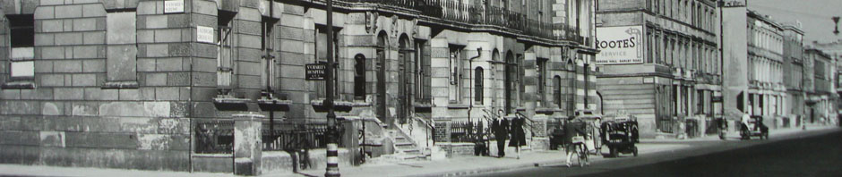
The speculative building around St. Michael’s with All Angels Church, Ladbroke Grove had faltered in the mid-nineteenth century when new properties saturated the targeted middle class market in such a manner as to cause houses to be let as multi-occupancy in streets like Faraday Road. Thus the development of part of Col. St Quintin’s Portobello Estate as drawn up by Henry Currey in 1865 which would have crossed Ladbroke Grove did not do so until quite a bit later. However the blocks of big houses between it and St Mark’s Road which includes St Charles Square, Chesterton Road, Basset Road, Oxford Gardens, and Cambridge Gardens were up within the following two decades when Oxford Gardens Board School was built in 1883.
Over the next twenty years terraces of housing grew up as ribbon infilling intensified across “the great stretch of common” until the conversion of pasture to urban expansion was complete.
Known dates for house construction include:
Highlever Road (part of) 1906,
Barlby Gardens 1916.
Pangbourne Avenue 1928.
Ernest E. Godin.
